


Space42 and Exodigo have partnered to bring AI-powered subsurface mapping to the UAE, targeting transport, utilities, energy and municipal projects in Abu Dhabi and Dubai.
The technology combines sensors, artificial intelligence and geospatial data to identify buried infrastructure without excavation. According to the announcement, it can locate utilities with up to 90% accuracy and reduce exploratory digging by up to 90%. Accuracy can reach up to 99% when a limited number of targeted test holes are added.
The partnership follows an initial project for a major oil and gas operator, in which Exodigo mapped a buried fuel line at depths of up to 14 metres without excavation. The survey took three days, with results delivered within two weeks.
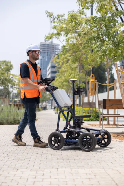
Exodigo’s system uses ground-penetrating radar, electromagnetic and magnetic sensors, LiDAR and seismic sources deployed through drones, vehicles, handcarts and backpacks. Its AI processes the data alongside utility records and aerial and street-level imagery to produce 3D maps that can be delivered in GIS, CAD and BIM formats.
The companies said Space42 will deliver Exodigo’s technology in the UAE. The partnership aims to connect satellite observations, surface-level data and underground mapping into a continuous view of infrastructure assets for government and enterprise users.
Source: Zawya