

Space42 and Exodigo are partnering to map underground infrastructure across the UAE, combining Exodigo’s sensing and artificial intelligence technology with Space42’s geospatial intelligence and digital twin capabilities.
The collaboration follows an initial project for an oil and gas operator, in which Exodigo located and mapped a buried fuel line at depths of up to 14 meters without excavation. The field survey took three days, with results delivered within two weeks, according to the announcement.
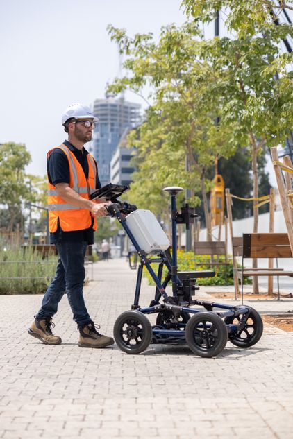
Exodigo scans an area using ground-penetrating radar, electromagnetic and magnetic sensors, LiDAR and seismic sources carried on drones, vehicles and portable equipment. Its AI models process and compare the geolocated readings with utility records and aerial and street-level imagery, producing a composite map of known and previously undocumented lines. The resulting layers can be used in GIS, CAD and BIM systems.
The company says its verified 3D models can map buried utilities with up to 90% accuracy without excavation, rising to up to 99% when a small number of targeted test holes are added. It also says its approach can reduce preliminary digging and drilling by up to 90%.
Under the partnership, Exodigo’s technology will be delivered in the UAE through Space42. The companies aim to combine satellite observation, street-level data and subsurface mapping to give infrastructure owners a continuous view of assets from above ground to bedrock. They are targeting transport, utilities, energy and municipal programs in Abu Dhabi and Dubai.
Hasan Al Hosani, CEO of Smart Solutions at Space42, said the companies plan to combine machine learning with Space42’s digital twin technology to support infrastructure planning and ground survey teams. Exodigo co-founder and CEO Jeremy Suard said the technology is intended to address gaps between infrastructure records and actual underground conditions.
Source: Zawya AI